Status now
Volcanic systems
Most active systems — count of M≥0.1 quakes (micro-quakes shown on the map), not the official aviation colour code. Official status: vedur.is. Dot: elevated · active · quiet.
| Volcanic system | 14 d | 24 h | 48 h | Largest | Activity |
|---|---|---|---|---|---|
| Katla (Mýrdalsjökull) | 18 | 44 | M3.3 | elevated | |
| Tjörnes / Grímsey | 11 | 15 | M1.2 | active | |
| Reykjaneshryggur | 9 | 63 | M3.2 | elevated | |
| Eldey / Reykjanestá | 8 | 17 | M2.2 | active | |
| Þeistareykir | 8 | 9 | M1.1 | elevated | |
| Grímsvötn | 5 | 20 | M1.3 | active ↑71 mm/yr | |
| Suðurlandsbrotabelti | 5 | 12 | M2.0 | active | |
| Hengill | 5 | 7 | M1.7 | active | |
| Krýsuvík | 4 | 6 | M1.8 | active | |
| Ljósufjöll | 4 | 6 | M1.4 | active |
Show all systems (17)
| Volcanic system | 14 d | 24 h | 48 h | Largest | Activity |
|---|---|---|---|---|---|
| Brennisteinsfjöll | 2 | 8 | M0.9 | active | |
| Hekla | 2 | 4 | M0.8 | active | |
| Bárðarbunga | 1 | 8 | M1.6 | active ↑64 mm/yr | |
| Reykjanes / Svartsengi | 1 | 3 | M1.8 | active step deform. | |
| Prestahnúkur | 1 | 3 | M1.1 | active | |
| Askja | 1 | 2 | M1.1 | active ↑38 mm/yr | |
| Esjufjöll | 1 | 2 | M1.2 | active | |
| Hrómundartindur | 1 | 2 | M0.9 | active | |
| Tindfjallajökull | 1 | 1 | M1.2 | active | |
| Krafla | 1 | 1 | M0.7 | active | |
| Kolbeinseyjarhryggur | 1 | 1 | M1.0 | active | |
| Eyjafjallajökull | 0 | 4 | M2.5 | quiet | |
| Vatnafjöll | 0 | 3 | M0.9 | quiet | |
| Eyjafjarðaráll | 0 | 2 | M0.9 | quiet | |
| Öræfajökull | 0 | 1 | M1.2 | quiet ↑734 mm/yr | |
| Fagradalsfjall | 0 | 0 | M-1.1 | quiet | |
| Torfajökull | 0 | 0 | M-0.2 | quiet |
What does the Activity column mean?
β = how many standard deviations the last-24 h count is above the system 2-year mean (β≥2 = elevated, β≥4 = unusually high) — a statistical swarm signal. Backtest (2 years): β≥2 flags an ongoing swarm at about 5× the baseline rate, but predicts large earthquakes (M≥3) poorly — an activity measure, not a forecast. The β number shows on hover.
Map
Trends, uplift and background — charts for the curious
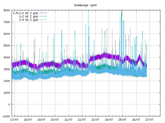
🌊 Volcanic tremor — Katla (Mýrdalsjökull) — The baseline tremor is currently low and should only be compared to recent days since win…
Depth is automatic and uncertain; earthquakes alone do not show magma movement — deformation (GPS) and gas are needed. Grey points: automatic fixed-depth values. b-value computed for M≥1.5 (automatic magnitudes make lower completeness unreliable). Preliminary data.
By active region (last 7 days):
- Reykjanesskagi (272 quakes last 7 d) — most resembles 7 August 2025 (339 quakes then)
- Eystragosbelti (262 quakes last 7 d) — most resembles 18 January 2025 (187 quakes then)
- Tjörnesbrotabelti (106 quakes last 7 d) — most resembles 23 March 2025 (132 quakes then)
- Suðurlandsbrotabelti (57 quakes last 7 d) — most resembles 24 June 2026 (53 quakes then)
Each active zone is compared with its OWN history (count, moment, depth over 7 days). It only shows the state is not unprecedented — no forecast; two years of history miss rare large events.
Uplift — GNSS deformation (Reykjanes)
Crustal deformation from continuous GNSS (Nevada Geodetic Lab, Eurasia plate-fixed). Up = land rising (possible magma accumulation), down = subsidence. Daily final solution with about a three-week lag (latest 2026-06-27); third-party reprocessing, not the Met Office real-time solution.
InSAR. InSAR (Sentinel-1 radar) maps surface deformation across the whole area, complementing the GNSS point measurements. Raw interferograms need expertise to read, so they are not shown here — interpreted deformation maps and current status: Icelandic Met Office · raw data: COMET LiCSAR.
Gas / SO₂. Volcanic gas (SO₂) is not shown here from raw data — Sentinel-5P TROPOMI needs heavy integration and is often faint at high latitudes outside major eruptions. Interpreted gas monitoring: air quality (Environment Agency) · MOUNTS Reykjanes ↗ · Copernicus atmosphere.
Satellite thermal anomalies (VIIRS · NASA FIRMS)
4 thermal anomalies detected in the region over the last 48 h, mostly near: scattered. Thermal anomalies can indicate active lava but also other heat (industry, fires); confirm at vedur.is.
By region (48 h)
| Region | Count |
|---|---|
| Other areas | 183 |
| Mýrdalsjökull (Katla) | 80 |
| Reykjanesskagi | 55 |
| Vatnajökull (Bárðarbunga/Grímsvötn) | 33 |
| Tjörnes / N-land | 18 |
| Hekla | 5 |
| Langjökull | 1 |
Latest earthquakes · updated 2026-07-26 18:20 UTC
| Time (UTC) | Mag | Depth (km) | Area |
|---|---|---|---|
| 2026-07-26 18:07 | M-1.1 | 5.2 | Other areas |
| 2026-07-26 16:59 | M0.3 | 0.0 | Reykjanesskagi |
| 2026-07-26 16:28 | M-0.6 | 5.2 | Mýrdalsjökull (Katla) |
| 2026-07-26 16:25 | M1.1 | 5.4 | Tjörnes / N-land |
| 2026-07-26 16:20 | M0.8 | 11.6 | Reykjanesskagi |
| 2026-07-26 16:20 | M1.0 | 9.7 | Reykjanesskagi |
| 2026-07-26 16:16 | M1.0 | 0.8 | Mýrdalsjökull (Katla) |
| 2026-07-26 16:07 | M0.2 | 0.0 | Hekla |
| 2026-07-26 16:07 | M2.1 | 9.6 | Reykjanesskagi |
| 2026-07-26 16:05 | M0.8 | 5.6 | Vatnajökull (Bárðarbunga/Grímsvötn) |
| 2026-07-26 15:59 | M1.2 | 9.2 | Other areas |
| 2026-07-26 15:54 | M2.0 | 0.5 | Mýrdalsjökull (Katla) |
| 2026-07-26 15:29 | M0.7 | 0.0 | Other areas |
| 2026-07-26 15:28 | M-0.4 | 5.2 | Mýrdalsjökull (Katla) |
| 2026-07-26 15:26 | M0.6 | 0.0 | Other areas |
| 2026-07-26 15:26 | M0.7 | 9.7 | Reykjanesskagi |
| 2026-07-26 15:16 | M-0.4 | 5.1 | Reykjanesskagi |
| 2026-07-26 15:03 | M0.4 | 5.2 | Mýrdalsjökull (Katla) |
| 2026-07-26 14:19 | M0.1 | 10.9 | Vatnajökull (Bárðarbunga/Grímsvötn) |
| 2026-07-26 13:36 | M1.0 | 6.5 | Mýrdalsjökull (Katla) |
| 2026-07-26 13:24 | M-1.0 | 5.1 | Mýrdalsjökull (Katla) |
| 2026-07-26 13:17 | M1.2 | 4.9 | Reykjanesskagi |
| 2026-07-26 13:05 | M0.4 | 4.7 | Other areas |
| 2026-07-26 11:56 | M1.2 | 1.1 | Vatnajökull (Bárðarbunga/Grímsvötn) |
| 2026-07-26 11:53 | M0.1 | 3.2 | Reykjanesskagi |
| 2026-07-26 11:53 | M-0.1 | 3.3 | Other areas |
| 2026-07-26 11:46 | M-1.1 | 11.5 | Reykjanesskagi |
| 2026-07-26 11:36 | M1.7 | 7.2 | Other areas |
| 2026-07-26 10:53 | M0.4 | 5.0 | Other areas |
| 2026-07-26 10:14 | M0.6 | 3.6 | Other areas |
| 2026-07-26 10:04 | M0.0 | 6.3 | Other areas |
| 2026-07-26 10:04 | M-0.4 | 1.9 | Other areas |
| 2026-07-26 10:04 | M-0.4 | 1.5 | Other areas |
| 2026-07-26 10:04 | M-0.3 | 1.2 | Other areas |
| 2026-07-26 10:02 | M0.8 | 3.7 | Other areas |
| 2026-07-26 10:00 | M0.1 | 0.0 | Other areas |
| 2026-07-26 10:00 | M0.2 | 1.1 | Other areas capital area |
| 2026-07-26 09:39 | M0.2 | 6.8 | Reykjanesskagi |
| 2026-07-26 09:38 | M-0.1 | 8.3 | Other areas |
| 2026-07-26 09:36 | M-0.4 | 8.2 | Other areas |